Train-Sim.Com
MSTS Route Design

Routes using "real" terrain

Notice to all visitors and members of the Train-Sim.Com message forums:
If you plan on using a signature banner in your posts, we would like to remind you that there is a maximum size for banners. That maximum is 450 pixels wide by 120 pixels high, and not to exceed 25k. Your compliance is appreciated. FORUM RULES Problems? There are two common reasons for problems with logging in and posting messages. The first is that you are running a firewall that prevents your messages from being sent to the server. The other is that you have cookies disabled; the DCForum software requires cookies to work properly.

Previous Topic | Next Topic

Printer-friendly copy Email this topic to a friend

Reading Topic #12701

Member since Jun-19-04 · 298 posts

Click to send message via ICQ

Does anyone know which of the add-on routes available (both freeware and payware) that use "real" terrain? IE has terrain made with DEMEX or similar tools instead of by hand? Off hand I can think of two, Crawford Hill and Whitefish 5. But there's gotta be more, especially among payware add-ons?

Leiv Eiriksson was first - Christoffer Columbus used a Viking map!

Alert | IP

Printer-friendly page | Edit | Reply | Reply With Quote | Top

RE: Routes using "real" terrain, werner001, Nov-12-04, 08:01 AM, (1) RE: Routes using, OTTODAD, Nov-12-04, 08:13 AM, (2) RE: Routes using "real" terrain, dwkarch, Nov-12-04, 08:23 AM, (3) RE: Routes using, charlie, Nov-12-04, 08:56 AM, (4) RE: Routes using "real" terrain, lfriddle, Nov-12-04, 03:01 PM, (5) RE: Routes using "real" terrain, Railfan727, Nov-14-04, 02:45 PM, (6) RE: Routes using "real" terrain, eerbaugh, Nov-21-04, 09:16 PM, (11) RE: Routes using "real" terrain, Coonskin, Nov-14-04, 03:35 PM, (7) RE: Routes using "real" terrain, SanDiegoMark, Nov-14-04, 10:29 PM, (8) RE: Routes using "real" terrain, yellowdog, Nov-16-04, 12:22 PM, (9) RE: Routes using "real" terrain, landnrailroader, Nov-16-04, 09:10 PM, (10)

Conferences | Topics | Previous Topic | Next Topic

Member since Sep-26-03 · 288 posts

RE: Routes using "real" terrain

Routes using "real" terrain – image 4

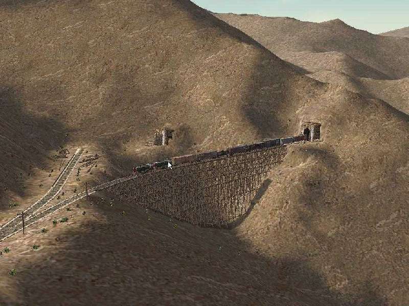
Rollins/Moffat uses real terrain. I would think that almost all routes use real terrain, particularly mountain routes.

Don Karch
Rollins Pass/Moffat Tunnel Route completed
C&S Platte Canon & Gunnison Districts narrow gauge in progress

Alert | IP

Printer-friendly page | Edit | Reply | Reply With Quote | Top

Charter Member · 339 posts

RE: Routes using

I haven't downloaded a route in "forever" that doesn't use some form of real terrain, whether by DEMEX, TSTools, or TS TerraForm. Oops, forgot about the PO&N; it may not have DEMed terrain.http://www.digital-rails.com/demex_users.htmlWith the increased availability of DEM data at places other than the US, it just gets better elsewhere.http://digital-rails.com/supportforum/viewtopic.php?t=103regards,
charlie

Alert | IP

Printer-friendly page | Edit | Reply | Reply With Quote | Top

Charter Member · 620 posts

RE: Routes using "real" terrain

My FRISCO - Fort Smith Subdivision not only uses real terrain, but even the objects were placed as closely as to the correct spot as three years of working with photomaps would allow.Andre Mings (Coonskin)St. Louis & North Arkansas route is a fictional representation of a railroad that no longer exists, but the terrain and track beds are real.Larry

Alert | IP

Printer-friendly page | Edit | Reply | Reply With Quote | Top

Charter Member · 992 posts

RE: Routes using "real" terrain

My Conrail Indianapolis Line uses real terrain as well, and the objects were placed using photomaps.Same for my Indiana Northern Railroad (under development)... modern-day free-lanced railroad based on the network of former Pennsylvania RR lines radiating out of Logansport, Ind. Most of these lines have been removed, but the terrain and rights-of-way are real.

Alert | IP

Printer-friendly page | Edit | Reply | Reply With Quote | Top

Member since Aug-1-02 · 3376 posts

RE: Routes using "real" terrain

Hi USRailFan:As you can see, most route builders now use DEM or other forms of digital data to create their route terrain.There are a few exceptions by some of the very creative types, but for the most part, we tend to stick with DEM data.In the past, I used DEM with some hand formed for one or two of my freelanced efforts, but I too, have evolved to using actual terrain, even for my "proto-lanced" route efforts with no major modifications other than right of way forming, etc.The list of routes using DEM would be long and lengthy. It may be easier to amass a list of those that don't.
Andre MingVisit VSC's temporary web page at: http://www.vscalecreations.comVisit VSC's Forum at: http://www.3DTrains.comRoutes using "real" terrain – image 5

Alert | IP

Printer-friendly page | Edit | Reply | Reply With Quote | Top

Charter Member · 1893 posts

RE: Routes using "real" terrain

The Kingsport and Blue Ridge Subs both have real terrain. I assume Sandpatch and Cascades Crossing do, too, but I'm not 100% on that. One of these days I'd like to move the BR Sub out of the way of the "White Void" and then Scale Rail the whole thing, but that "one of these days" is certainly not anywhere in the near future.

Clayton

Alert | IP

Printer-friendly page | Edit | Reply | Reply With Quote | Top

Charter Member · 1624 posts

RE: Routes using "real" terrain

The RMD-2 (Rocky Mountain Division, 2nd subdivision, Milwaukee Road) uses real terrain that is better than my earlier routes, the KP and BR sub., in that it was extracted (DEMEX) from the relatively new seamless USGS data - been out almost 2 years now.Likewise the RMD-4, which I expect to release late December/early January uses seamless data.The advantage is that there no scenery voids or peaks to smooth out, although sometimes along a tile boundary, there will be a noticable dimple, but nothing like in the past and I just put extra thick foliage in those spots.To be honest about it, I doubt that any routes are hand sculpted anymore unless they are of non-US routes (I think good data is also available for Canada). For example, Michael Vone hand sculpted his Albula sims. which are excellent by the way if you want to operate a REAL MOUNTAIN RAILROAD.J. H. Sullivan

Alert | IP


[ Home | MSTS Forum | MSTS FAQ | How To... | File Library ] Copyright © 2004 by Nels Anderson. All Rights Reserved.

Restored from the Train-Sim.Com archive, captured November 22, 2004. About this archive.