Notice to all visitors and members of the Train-Sim.Com message forums: If you plan on using a signature banner in your posts, we would like to remind you that there is a maximum size for banners. That maximum is 450 pixels wide by 120 pixels high, and not to exceed 25k. Your compliance is appreciated. FORUM RULES Problems? There are two common reasons for problems with logging in and posting messages. The first is that you are running a firewall that prevents your messages from being sent to the server. The other is that you have cookies disabled; the DCForum software requires cookies to work properly.
Hi DecapodOne of the things I find myself doing a lot in creating scenery objects is to remove several of the distance levels created on 3D Canvas export, leaving only two. To do this I have to manually edit the shape file.Could SFM be applied to this task, say by setting a particular LOD distance to zero in order to remove it entirely?Thanks again for an excellent tool.cheers
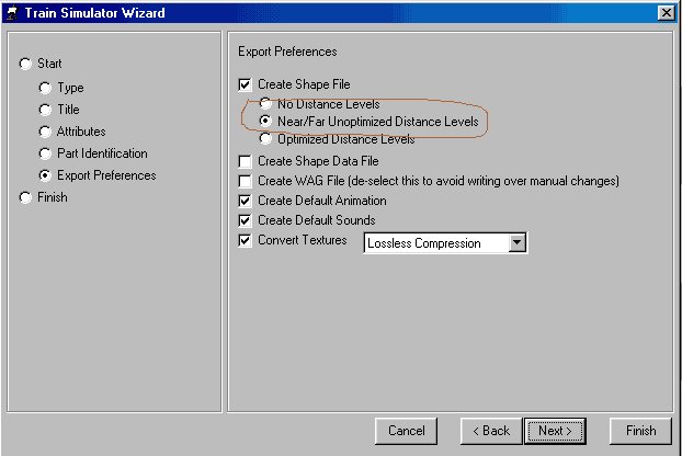
Why not just tell 3D Canvas to do *only* Near/Far LOD... That way you only get two to start with. At that point you can use what SFM already does and just adjust the "switchover" distance point for the LOD.Pete Willard
Hi Pete,Thanks for the tip. I don't use the Wizard (never got around to it, being happy with my present methods), and I had been manually selecting the optimized distance levels rather than the simple distance levels.I think I understand now: simple distance levels means just two LODs, one with all the detail for up-close and one with only the objects in the MAIN frame for faraway viewing. Optimized distance levels include the same two LODs along with several additional LODs in between, automatically generated by the polygon reduction operations-- which only work provided that each object in the model is textured with only a single texture.I wish there were direct control over LODs in 3DCanvas, i.e. making a separate model for each LOD. Right now I think that involves some significant mucking around in the shape file.cheers
True, it is a bit complex - people have asked for a "merge shape file" option which would enable us to design each distance level as a separate model - It is feasible, but could be a few months away as my schedule is qutie busy at the moment.



 Pete Willard