Wouldn't the Fraser Canyon (a CN run) from Vancouver to Kamloops be a great one? Anybody interested in helping? My design skills are somewhat limited, but I've got pleny of ideas!cheers
steve
Printer-friendly page | Top
Notice to all visitors and members of the Train-Sim.Com message forums:
If you plan on using a signature banner in your posts, we would like to remind you that there is a maximum size for banners. That maximum is 450 pixels wide by 120 pixels high, and not to exceed 25k. Your compliance is appreciated. FORUM RULES Problems? There are two common reasons for problems with logging in and posting messages. The first is that you are running a firewall that prevents your messages from being sent to the server. The other is that you have cookies disabled; the DCForum software requires cookies to work properly.
Archived thread - Read only
Previous Topic | Next Topic
Printer-friendly copy Email this topic to a friend
Reading Topic #119
Wouldn't the Fraser Canyon (a CN run) from Vancouver to Kamloops be a great one? Anybody interested in helping? My design skills are somewhat limited, but I've got pleny of ideas!cheers
steve
Printer-friendly page | Top
Considering this was one of the hardest routes to construct in the real world I do not think it would be much different in MSTS. Your definantly going to need to create some new buildings, bridges, and tunnel architecture if you want it to look realistic. There is ALOT of different kinds of tunnels on this route. Lots of mountains, water, bridges and cliffs. I'm going to need way more practice before I can start making real world terrain and scenery from pictures etc. I am trying to learn how to build terrain and optimize it for rendering speed. Here is a few pics of a route I am playing with that was inspired by the glory of the Fraser Canyon. These are definantly work in progress I am not even finished tweaking the terrain. You can go on for hours and hours. Here is a good tip tho... You can use 45degree yard curves to carve out some nice rivers =)Here is the Orient Express with a full rake crossing my yet to be named bridge on a brisk autum morning.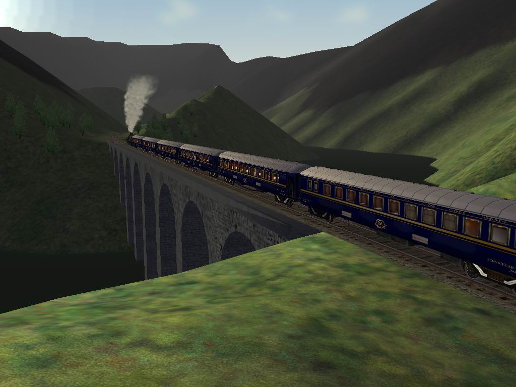
Here is a simular picture taken on a cold winter morning. For those who do not know even your trees shed their leaves in the winter on some types of trees =)
Printer-friendly page | Top
i would be very interested in making the fraser canyon route, i camp along it every summer. i have some knowlage of using the editors and live in the area. but you would need to have the CP line also to make it accurate because they use one side of the canyon for westbound traffic and one side for eastbound traffic.
Printer-friendly page | Top
[ Home | MSTS Forum | MSTS FAQ | File Library ] Copyright © 2002 by Nels Anderson. All Rights Reserved.
Restored from the Train-Sim.Com archive, captured May 28, 2003. About this archive.